
To the south of Castle Douglas in Dumfries & Galloway lies the picturesque coastal village of Kippford. Sitting at the mouth of the River Urr where it meets the Solway Firth, this narrow village is known as the ‘Solway Riviera’ and is one of the most expensive places to buy a home in all of Dumfries & Galloway.
Yachts bob in the harbour as visitors stroll along the promenade, cafe’s bustle with customers as seagulls drift overhead. It is one of the prettiest (and most popular) coastal towns in the region and it is the start of a spectacular 10-mile coastal walk that is quite possibly my favourite of all the wonderful coastal walks in Dumfries & Galloway.
The Walk
There are actually two main walks in the area. One, is a short circular walk from Kippford to Rockcliffe, a 3.5 mile walk along the coast and through a little bit of woodland. It has beautiful sea views, two gorgeous villages and plenty of opportunity to stop for a coffee or an ice cream!
“A popular wooded coastal walk between the two picturesque waterside villages of Kippford and Rockcliffe“
The other route is a 4.5 mile coastal walk on spectacular cliffs from Kippford to Sandyhills. It features fantastic coastal views to the Lake District and multiple sites of historical interest (from a ruined hermit cottage to the graves of lost sailors) before arriving at a gorgeous sandy beach with an impressive rock formation.
This superb linear coastal walk links picturesque Rockcliffe with the sandy beach at Sandyhills. In between there is some excellent coastal and clifftop scenery with great views up and down the coastline as well as across the Solway Firth.
Now, while both of these walks sounded great, they both felt a bit too short. The solution? Click them together, creating one large, sprawling coastal trek through 3 beautiful villages (Kippford, Rockcliffe and Port o’Warren) before arriving at the fantastic beach at Sandyhills.
Kippford to Rockcliffe, Rockcliffe to Sandyhills, Sandyhills back to Rockcliffe, then Rockcliffe back to Kippford. A circuit of around 12 miles (depending on how you do it). Of course, you can just do the individual sections if you wish! Parking is available at all 3 stops allowing you to customise this route to your preference.
Now I must confess, I’d previously made an attempt at this walk and had run out of daylight and had to return to do it again another day! It’s not just that the walk is 10 miles and I’d done it in winter…it’s a problem of there being so much to see! If you are planning on doing the full walk, bare in mind you will be seeing a lot of fantastic scenery and a lot of fascinating history.
Kippford
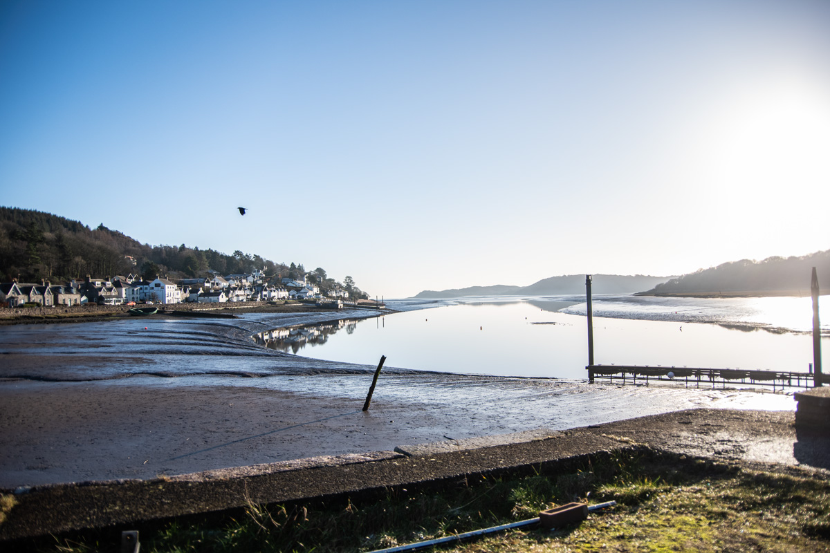
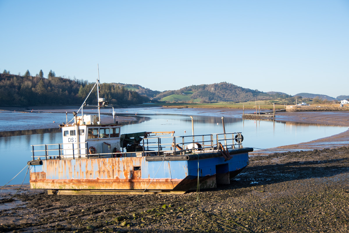
Kippford is the most well-known of the 3 villages and it’s the narrowest. It’s a sort of thin, coastal village that follows the esturary of the River Urr out to sea. I’d chosen to do this walk in winter, as I know how busy this area gets in the better months.
On a cold, crisp winter’s day, I pulled into the free carpark at Kippford and was greeted with a cloudless sky, a bright winter sun and fresh coastal air.
Just across from the parking area is the Solway Yacht Club, with loads of pretty white yachts sitting on their trailers, presumably waiting for better weather. It sets the tone immediately and I couldn’t resist strolling into the grounds and taking some pictures looking south, down along the river.
Next, was a stroll through the village in the morning sunlight. Thankfully, it was quiet but it didn’t mean it was empty. I was surprised to see visitors in the cafe’s enjoying a morning cup of tea while taking in the views. A few dog walkers were strolling along the promenade and I couldn’t help but take more pictures of the lovely village
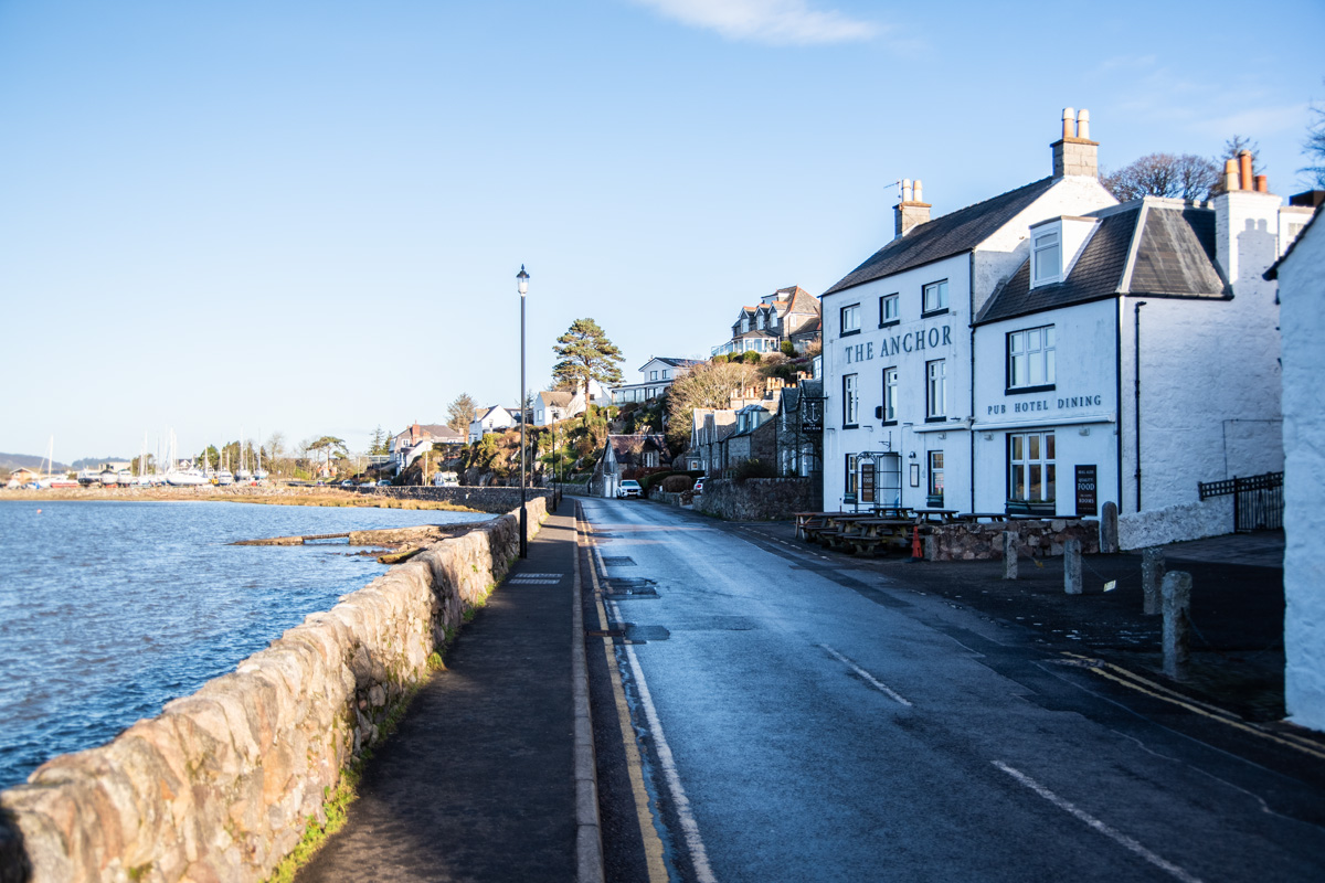
The small path continues to head south through the village, passing by many fantastic (and expensive) looking houses. There are also a welcome batch of benches dotted around the path, making for some very pretty rest-stops.
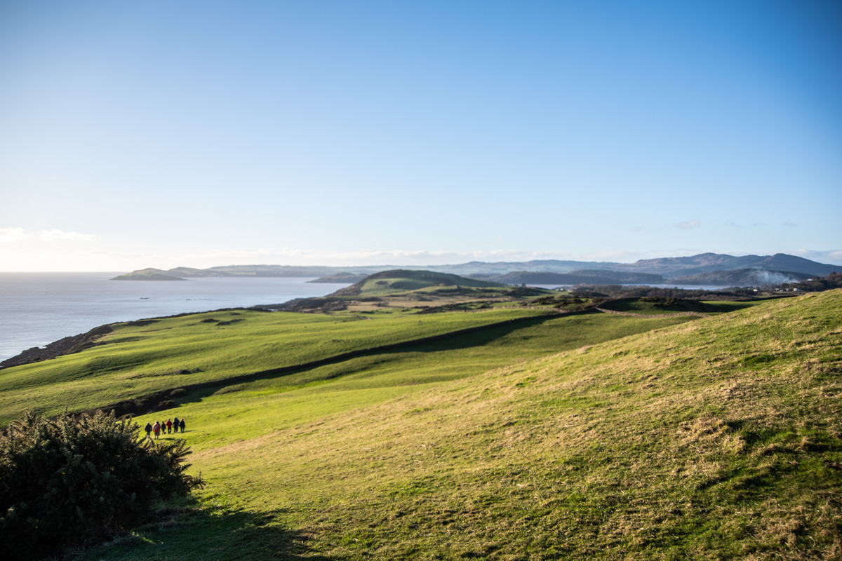
Eventually, the path swings up into the woodland which surrounds Kippford en-route to Rocklcliffe. Be sure to keep an eye on the fantastic views between the trees!
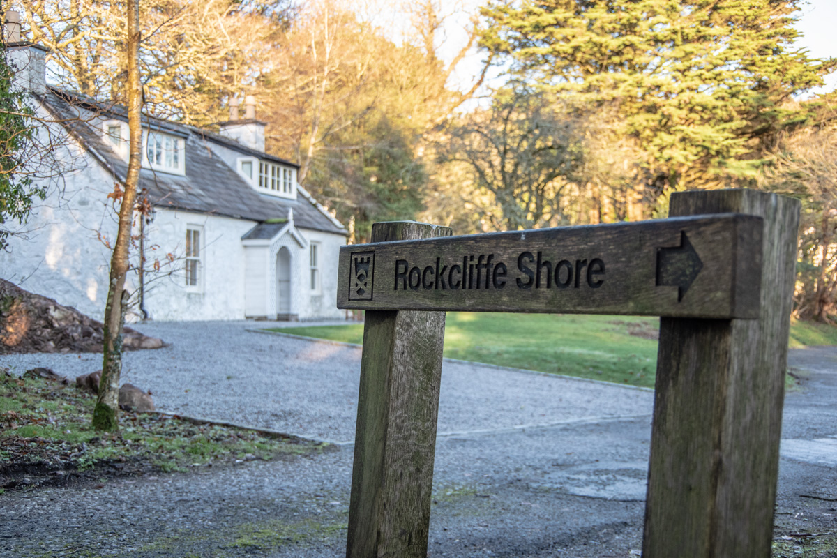
Rockcliffe
The walk is short and quite easy between the two villages, with nothing too strenuous in the woodland. The track descends out of the woods and arrives at yet another gorgeous coastal village: Rockcliffe.
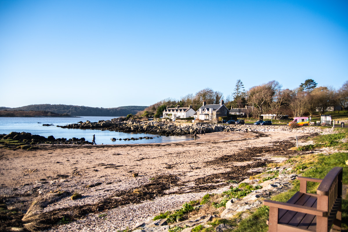
Now, if Kippford is narrow then Rockcliffe is wide. A circular beach, dotted with benches sits looking out to sea with rows of gorgeous houses rising in the hill behind. It’s achingly pretty and I am not sure if I actually prefer it to Kippford.
I was used to seeing an ice cream van here in summer…but it was also here in the winter! It was a lovely day but at no point had I thought to myself “I could really use an ice cream”.
Just beyond the little beach, a small signs points to a private road and the track which starts the next leg of the journey, from Rockcliffe to Port o’Warren.
Rockcliffe to Port o’Warren
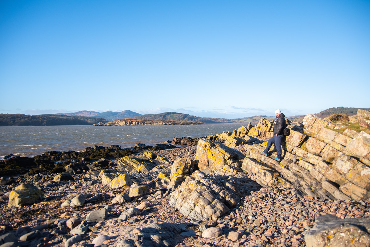
Once again, the walk passes more beautiful homes and joins the coastal track that makes up the vast majority of this walk. At first, it snakes through some light woodland before arriving at open coastline, just below the cliffs above. There are some fantastic rocks formations, which give way to the open sea, with the hills of Dumfries & Galloway behind. The clear blue skies of a winters day are made for these coastal walks and, even at this point, I was amazed at the spectacular scenery.
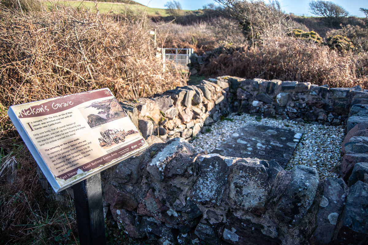
The first of many points of historical interest is found just as the path starts to climb onto the moors above the sea. It is ‘Nelson’s Grave’, a rather poignant tribute to Joseph Nelson, a sailor who died on the 2nd of January, 1791 after his vessel ‘The Ann’ was wrecked near Castle Point.
Only one body was ever discovered, that of Joseph, which washed ashore. He was buried where he was found and his widow erected this stone in his memory. He was from Whitehaven and the site has marked his passing for over 200 years. The lettering on the stone reads:
“In Memory of Joseph Nelson who was lost on his passage from Whitehaven 2nd Jan 1791 and was buried here July 20 following. Aged 59 years. This stone is erected by his widow Ann Nelson in (sic) Whitehaven.”
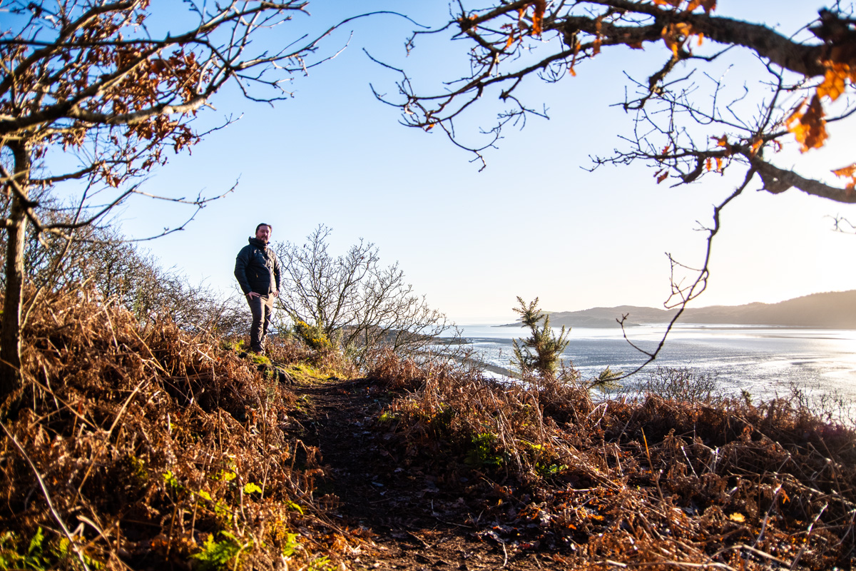
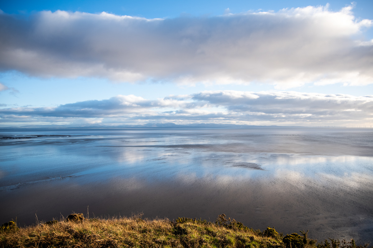
From Joseph’s grave, the path climbs gently up onto the moorland and suddenly I was high above the sea and arriving at Castle Point. It’s a fantastic viewpoint, high on the edge of a cliff with endless views out to sea over the Solway Firth and was once the site of an ancient fort, believed to be occupied from around 400 B.C. until the medieval period. It even has one of those fun little cairns with an inset sign which shows you where things are from your currently location.
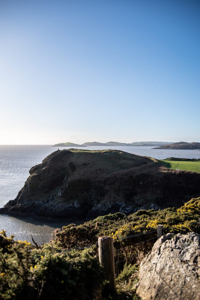
It’s another fantastic viewpoint and one that is well worth the walk even if you just want to start at Rockcliffe to see it. It reminds me of the views at Torr’s Point over at Kirkcudbright.
It’s from Castle Point that the real walk starts. There is nothing but sprawling coastal cliffs for miles from Castle Point to Port o’Warren and this section is the longest of the day. However, this walk was nowhere near done with giving me fantastic views and points of historical interest!
The small track climbs even high from Castle Point and reveals rolling fields and it isn’t long before another fascinating site of historic interest reveals itself. Passing a small interpretation board on ‘Smuggling and Shipwrecks’ reveals some wonderful caves in the cliffs below, used by smugglers in years past to hide their goods.
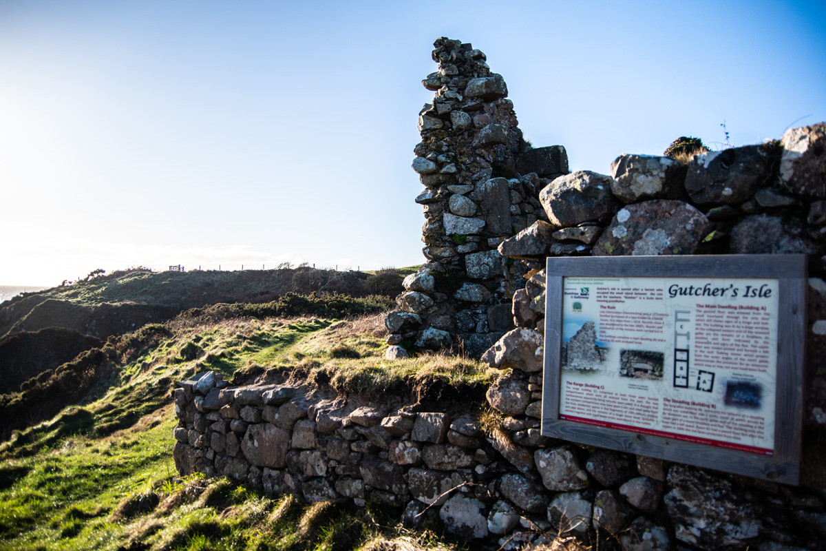
Then, a ruin appears on the left of the track. Which is a 17th century fortified farmstead, a ‘bastle house’ which dates from 1614 and it was eventually abandoned in the late 1800’s. This, however isn’t the most interesting part. The accompanying sign entitled ‘Gutcher’s Isle’ is even more interesting!
The area is named ‘Gutcher’s Isle’ after a hermit who lived in the area. He apparently lived on a small ‘island’ between the ruin and the seashore. The board informs that ‘Gutcher’ is an old Scots term meaning ‘grandfather’. As I stood reading this board, I couldn’t help but wonder what life was like for him, so many centuries ago.
Resuming the walk, I passed fields full of sheep and Belted Galloway cattle as the little track wound up and down along the coastline. In the distance, something was catching my eye. A sort of large cairn, below the path on a little rocky outcrop.
As I got closer it became apparent this was yet another fascinating historic site. It was indeed a cairn, adorned with a cross atop it. I was determined to make a detour to see it and, after walking down the gorse-strewn little track towards it, I was amazed to see it was yet another monument.
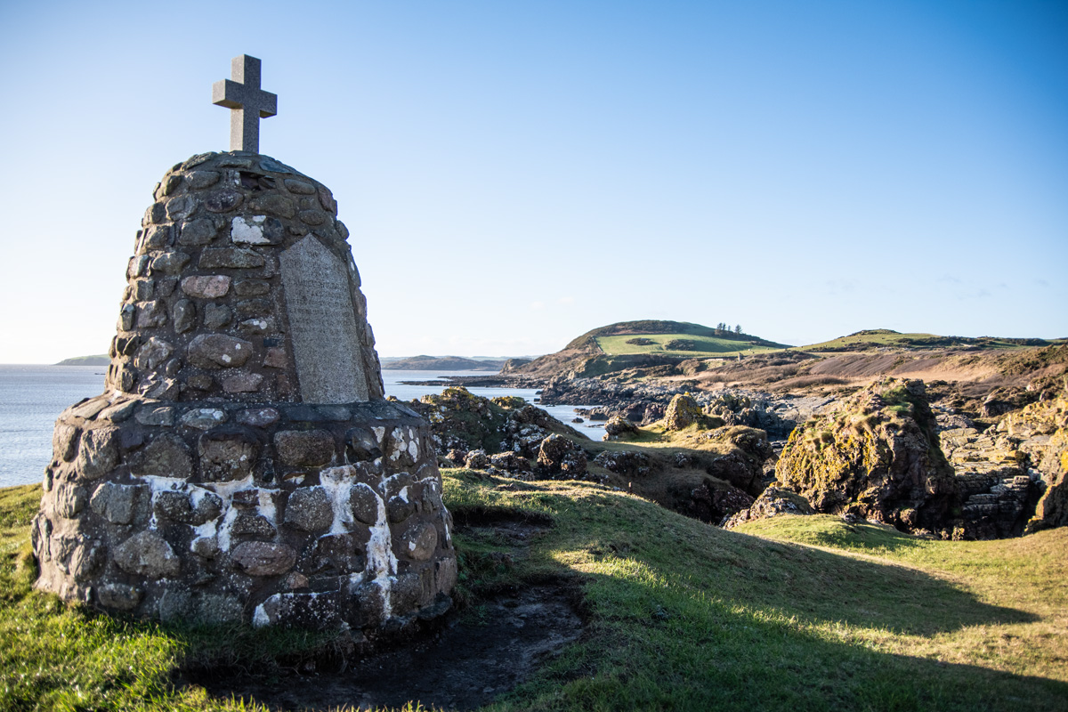
This fantastic monument is still readable (barely) and is dedicated to the schooner ‘Elbe’ and her captain Samuel Wilson. The ship was driven ashore during a fierce storm in December, 1866 and the crew of 7, including Captain Samuel Wilson were able to jump off onto the rocks before the ship was carried back out to sea before eventually sinking in deep water.
I’ve done a little research on this and some sites seem to claim that Captain Wilson died during the storm but it seems he survived and live to the grand old age of 98! The monument commemorates the loss of the vessel and the brave crew who survived.
I really love the site of this monument, sitting along on a little outcrop above the crags below. It makes for a wonderful stopping point and really lets you take in the surrounding scenery.
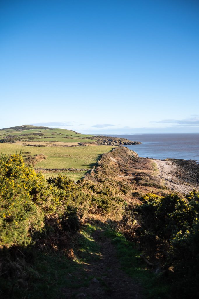
Rejoining the track, the one notable uphill section of the day begins, where the ascent to the hill at Port o’Warren begins. It’s nothing that bad and the reward is, once again, fantastic views over the Solway Firth and to a village I’d never visited before (and, to be honest, had barely heard of before) in Port o’Warren.
Port o’Warren to Sandyhills
Port o’Warren sits in a little valley between two hills, accessed by a single track road and is the epitome of a hidden village. It’s tiny, sitting just above the sea and would be a place that’d be easy to never know it existed.
I enjoyed just strolling through the village, admiring the lovely houses, some palm trees in the gardens and birds hopping between feeders. Yet again I thought “what a place to live”, as I admired the houses had over the Solway Firth.
It doesn’t take long to get through Port o’Warren and the last stretch to Sandyhills begins. The path continues along the coast, following a small dyke and fence through gorse-laden fields.
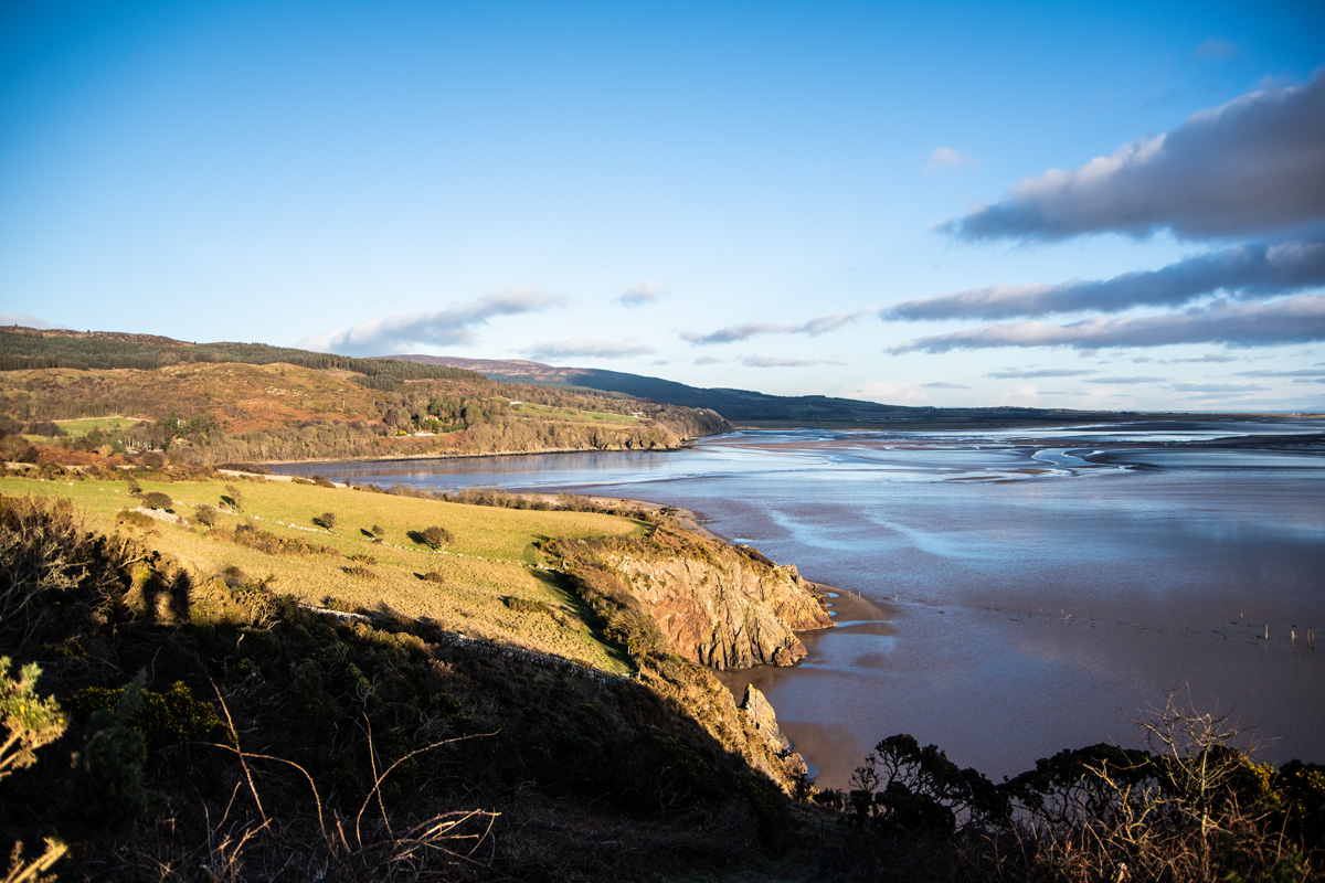
In the distance, I could see golden beaches, stretching from Sandyhills to Southerness. I was excited to see the beach at Sandyhills, which I’d heard is lovely (it frankly had better be with a name like Sandyhills!).
It was on the hill just above Sandyhills that I took one of my favourite pictures of the entire walk. An unninterrupted view to the Lake District, with the clouds reflecting on the sea below.
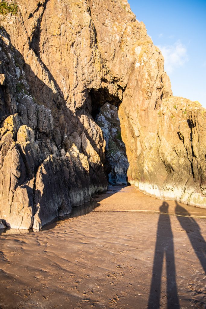
Suddenly, the path descends towards Sandyhills and I couldn’t help but notice an amazing rock arch on the beach below. My OS map had it noted as ‘Needles Eye’ (Natural Rock Arch) and you just can’t tell me about things like that without me wanting to go and see it. The tide was far, far out by this point and I could see many people (and dogs!) walking out on the flats.
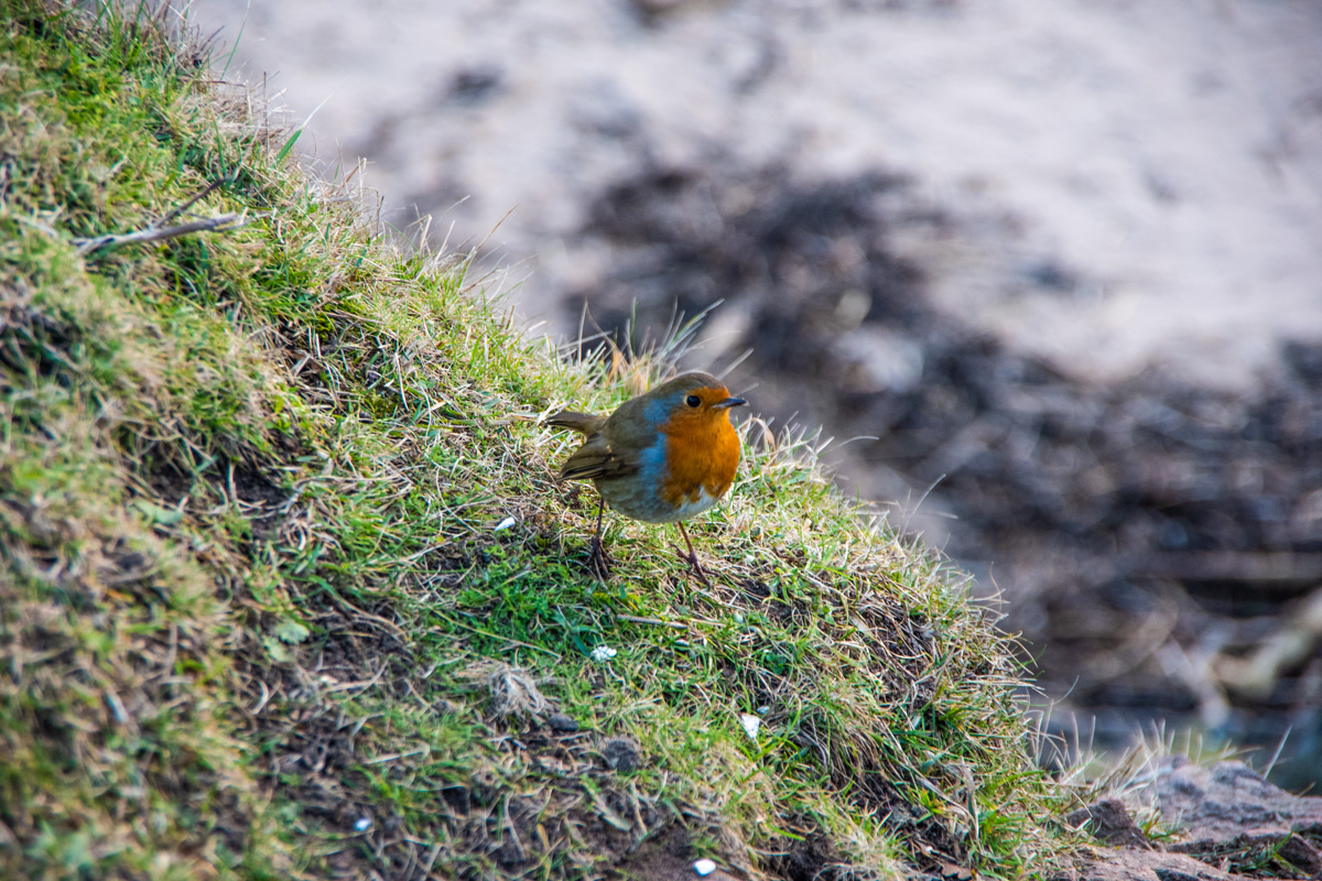
A quick descent through some fields and a little bit of woodland brought me to one of my favourite spots in the whole walk. Plus, it had a bench.
And a robin.
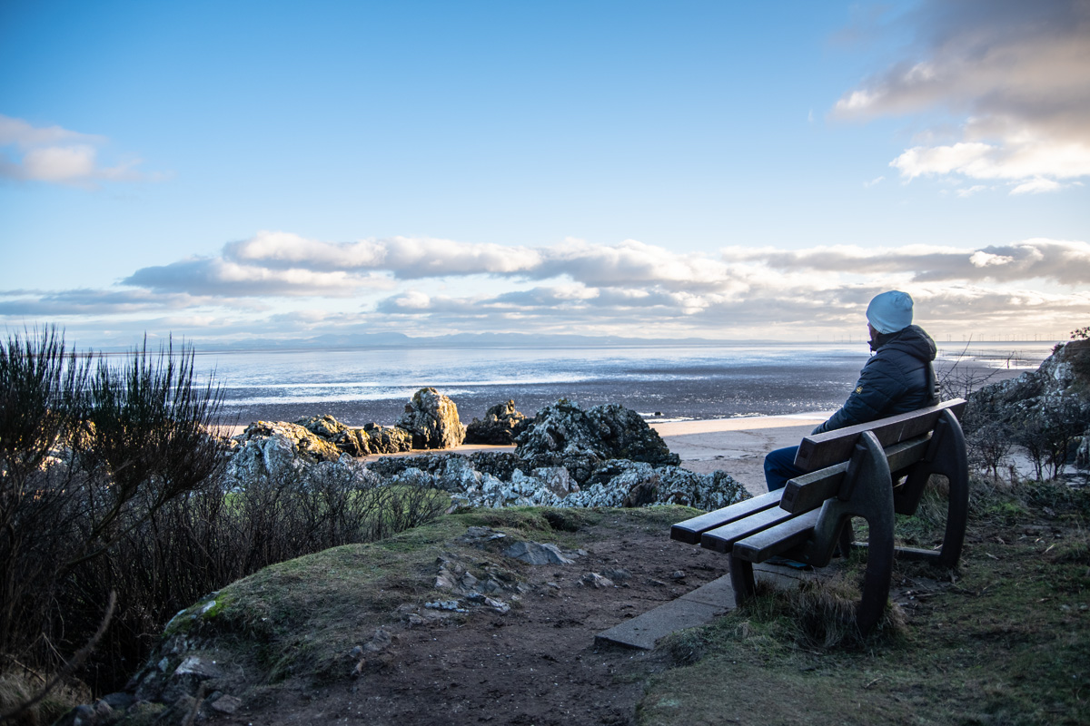
Perched on a little rocky outcrop, with a small path heading down to the beach, was a spectacularly placed bench. The gentle, setting winter sun was giving everything a lovely golden glow as the views overwhelmed me. Sitting there, at the edge of Scotland, with the Solway Firth spread before me was wonderful and the reason why I love walking and exploring so much. It was a moment of pure tranquility.
Well, it would have been. Except a very tame, very friendly robin had arrived at the bench too. Clearly very used to getting freebies from walkers, he seemed baffled by my lack of sandwich. Or biscuit. Or anything.
Doing laps around me, hopping onto my boot and, at one point, fluttering in front of my face as if to say “where the hell is your lunch and when am I getting some?”. My apologies to him didn’t seem to be enough and I departed, down on to the beach below to try and find the ‘Needles Eye’.
I’ll have to make sure I bring something next time.
Strolling along the big, sandy beach, I saw the remains of old fishing nets and admired the amazing cliff faces, some with hidden caves! It wasn’t long before I encountered the amazing ‘Needles Eye’ a giant rock arch, not unlike the one I recently saw at Powillimount.
Others were gathered around it, gazing up in awe at this amazing geological formation. I waited for a bit to get it to myself and had a walk through, marvelling at the scale of the arch and the echo inside!
It’s yet another must-see highlight of this walk. Just make sure you time it for low tide!
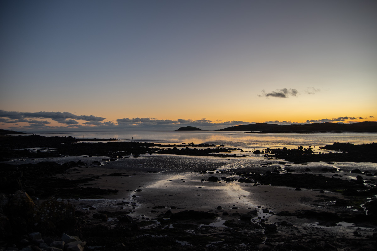
After having a last look at the arch, I headed back and followed the beach to the Sandyhills Caravan Park where rabbits were hopping in the foliage in front of the golden beach. The sun was setting over the hills and made me ready to head for home.
Heading Home
I’d decided not to head back the way I’d came. Partially because I wanted a change of scenery, but also because I didn’t fancy all the up-and-down of the coastal path! Instead, my plan was simple. Head back along the A710 until arriving at Colvend, then take the small country road which heads back to Rockcliffe.
This walk is far easier than the coastal route, being a pretty flat road which isn’t that busy, at least in winter. Passing Colven Golf Club and enjoying the rolling fields, it wasn’t long until I arrived in Colvend, a small village with a shop and a tea room and, of course, small lovely houses.
I really enjoyed the last stretch, turning onto the little road that descends to Rockcliffe. The sun was setting and covering everything in a golden, winter glow. The sea was shimmering with the silver and gold colours as I arrived in Rockcliffe.
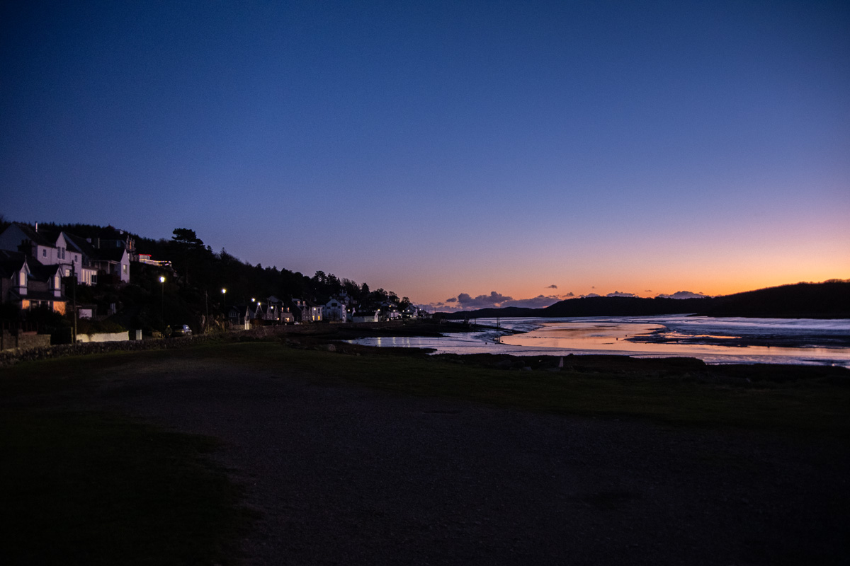
A brief walk back through the peaceful woodlands from earlier and I was in Kippford. The village was now quiet, very few tourists were left and I lovely the ambiance of the twinkling house lights as the sun set over the river. It was picturesque, tranquil and very, very pretty.
Conclusion
I’ve done a huge amount of coastal walking in Dumfries & Galloway and I have to say that this walk is the best of them all. It really has a bit of everything. From the beautiful villages, with scenic views and fantastic homes, to the huge coastal walk with spectacular views. The walk also has sites of real historical interest and even a geological arch!
The lovely beach with a rock arch reminds me of Carsethorn to Powillimount, the sprawling coastal route reminds me of Stairhaven and the huge looping circuit reminds me of Balcary to Rascarrel Bay.
The difference is this walk has it all. Plus you can do it largely any way you wish. You don’t have to do this full loop. You could park at Sandyhills and just enjoy the beach, the views and the Needles Eye. You could park at Kippford and just enjoy a stroll to Rockcliffe. You could park at Rockcliffe, grab an ice cream and pay a visit to Castle Point.
Not only is it my favourite coastal walk in Dumfries & Galloway, but it’s the most versatile of all them. There’s so much to see and so many ways to do it. It’s a must-do walk in Dumfries & Galloway and one of the finest coastal walks in the South of Scotland. Even when writing this blog post, I struggled to pick the pictures for it as I took around 200 when I did the walk and many lovely pictures had to be left out!
Let me finish with a quote from Dumfries & Galloway Council:
“The Rockcliffe to Sandyhills coastal path has been described as one of the best in Britain, with stunning views across the Solway to Cumbria and the Isle of Man as well as along the Galloway coast.”
It’s the best coastal walk in Dumfries & Galloway and it’s a must-walk if you are in the area.
Route Information
Parking: Free
Route Length: 12 Miles
Kippford Post Code: DG5 4LN
Rockcliffe Post Code: DG5 4QQ
Sandyhills Post Code: DG5 4NZ
Dumfries & Galloway Council Route Map (Rockcliffe to Sandyhills): HERE