
One of the most popular tourist spots in the Galloway Forest Park in Dumfries & Galloway is Clatteringshaws Loch, which is a large freshwater reservoir-loch that has a large carpark and visitor centre. The loch offers beautiful views to the Merrick ridge and Corserine and the Rhinns of Kells and I’ve lost count of the amount of times I’ve driven by it in the evening and have witnessed a stunning sunset over the water. In the summer months it’s very popular with tourists who enjoy a coffee at the cafe while taking in the views. I’ve also seen a huge amount of motorbike enthusiasts who use it as a nice pit-stop.

What many people don’t know is that there is a nice walk in the hills directly beside the visitor centre at the loch. Two hills tower over the south-side of the loch: the quirky-named Benniguinea (1,270ft) and the irritatingly named Black Hill of Dee (1,617ft). Why irritating? Well it is ALSO named Black Craig of Dee, or Cairnsmore of Dee or just Cairnsmore. As I researched this blog post it became more and more apparent that this hill is referred to by multiple names.
What IS important is that if you are a completionist, this is the 3rd piece of the ‘Cairnsmore’ hills in the area. So if you have bagged Cairnsmore of Fleet and Cairsnmore of Carsphairn, then you really need to bag Cairsnmore of Dee to say you have bagged them all!
Setting Out
One thing I have to highlight is parking for this walk. The visitor centre charges for parking (£4 for the day) so for doing this hike, I’d suggest parking in one of the many lay-bys that are scattered along the loch. One in particular, west of the visitor centre, is large and can hold multiple cars. This will leave you with a gentle 5 minute walk to the visitor centre carpark.
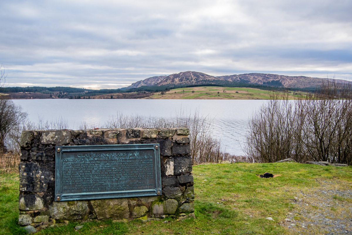
My first objective for the day was not to bag the two hills, instead it was to walk around the loch for 1 mile to complete the ‘Bruce’s Stone Trail‘ which ends at a stone against which Robert the Bruce is said to have rested. This is actually the second ‘Bruce’s Stone’ with the other (far larger and more impressive) being in Glen Trool (which you can read about HERE in my Merrick walk post). It’s a very easy, gentle little walk around the loch and one that would be perfect if you are just stopping on a nice summer day for a coffee and to soak in the atmosphere.

Benniguinea
We headed back to the visitor centre and crossed the road to the start of the trail to Benniguinea (it is exactly opposite the road into the visitor centre car park). It’s a very gentle trail, that curls upwards, through a little gate, before entering the woodland. When you head into the woods you should make sure you have checked an OS map before heading off as there are multiple paths but only one takes you to the summit of Benniguinea.
My biggest tip would be, stay on the main path and don’t turn off until the 2nd main right turn. A couple were walking ahead of me and I noticed them take the first right turn (I bumped into them later on the summit where, sure enough, they told me they’d gone the wrong way).
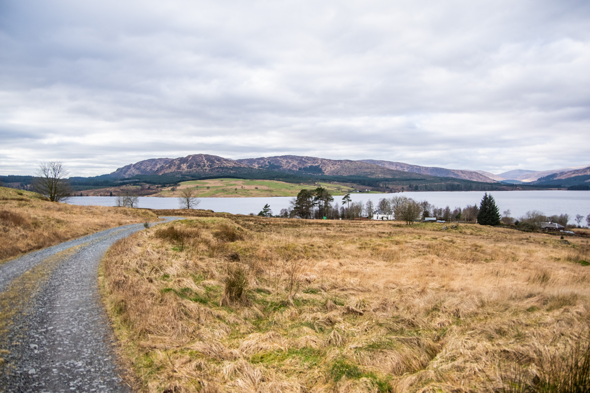
If you are just visiting the area and perhaps not wanting too big a walk, then the stroll from the visitor centre to the summit of Benniguinea is really quite easy. Including the detour to Bruce’s Stone, climbing Benniguinea from the visitor centre and back takes just 5 miles. The entire walk is on forestry tracks and is a perfect little walk if you have stopped at the visitor centre (and are trying to work up an appetite for the cafe!).
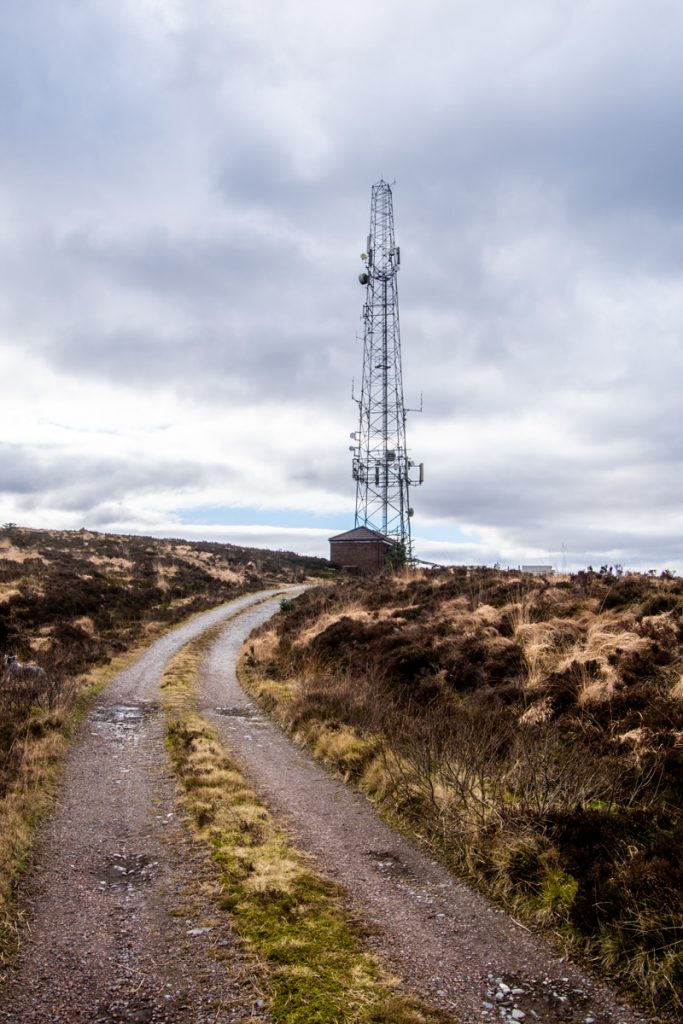
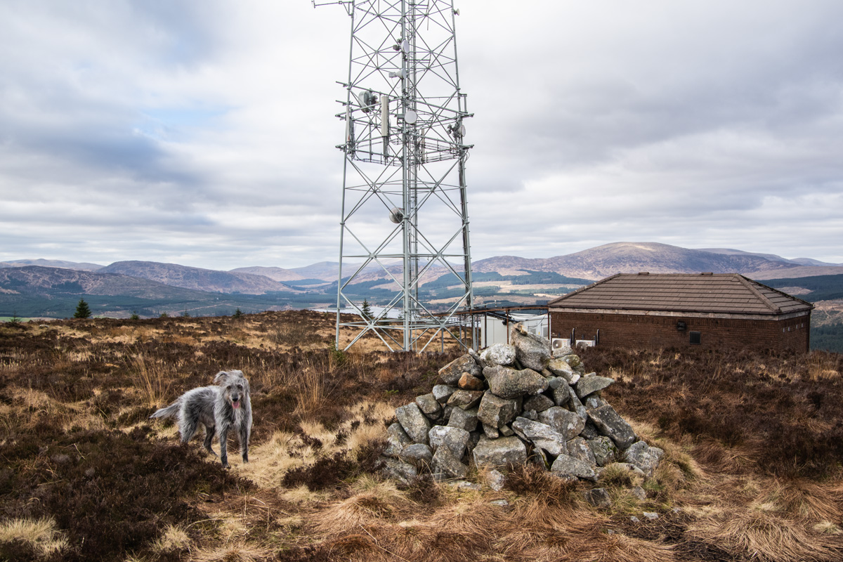
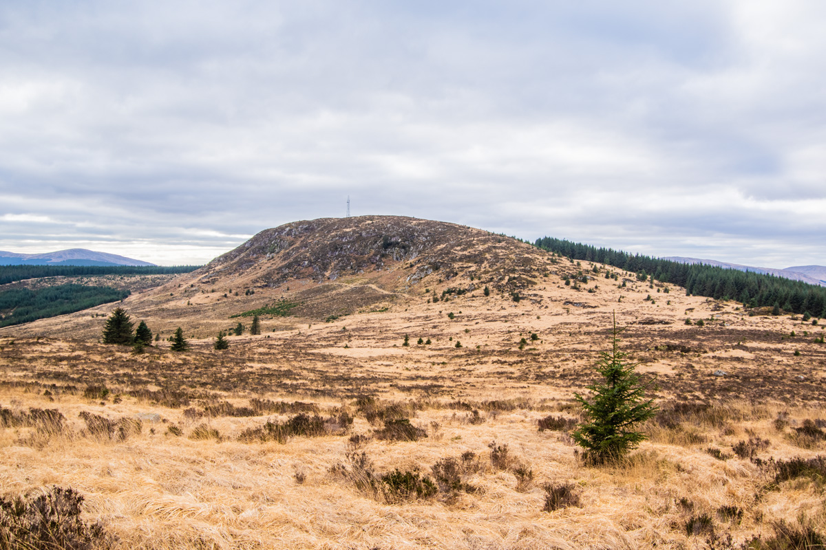
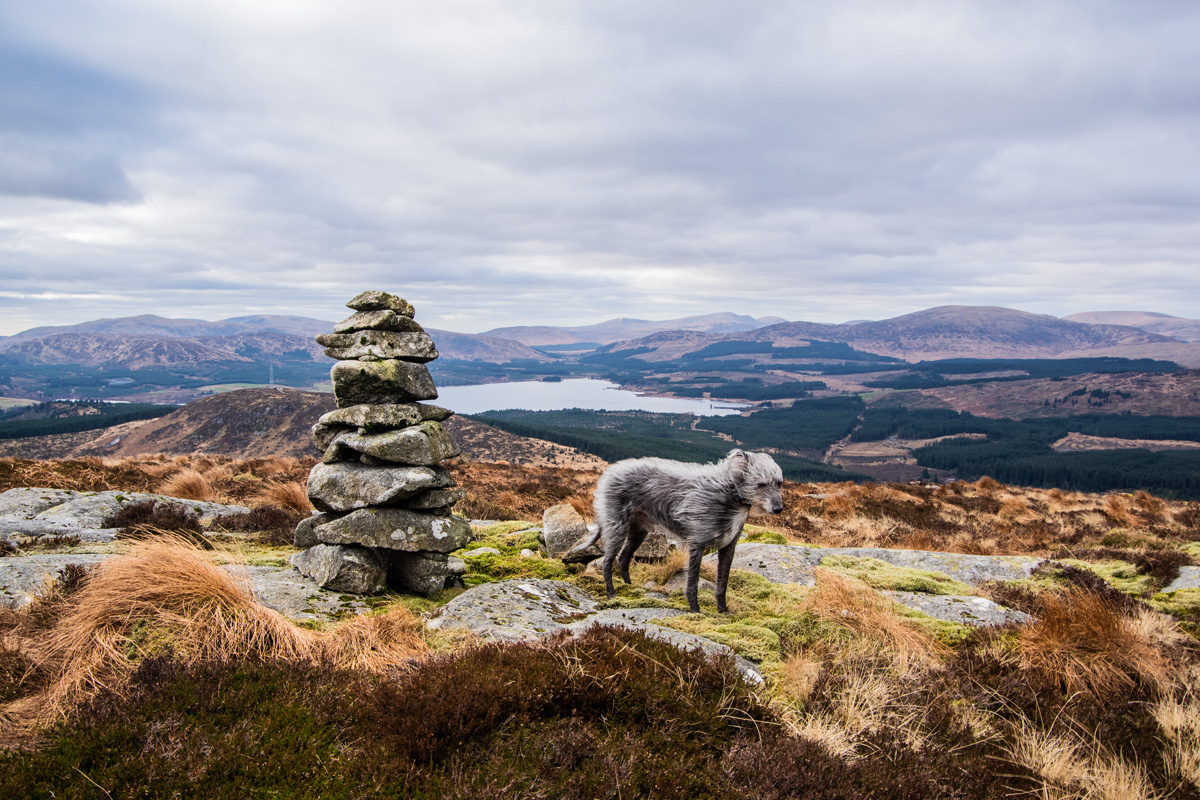
We had climbed up through the woodland and before I knew it the huge radio mast on the summit of Benniguinea was stretching high above us. It had been a very easy walk and despite the somewhat ugly summit, the views over the loch and over to the surrounding hills was well worth the effort.
Black Hill of Dee
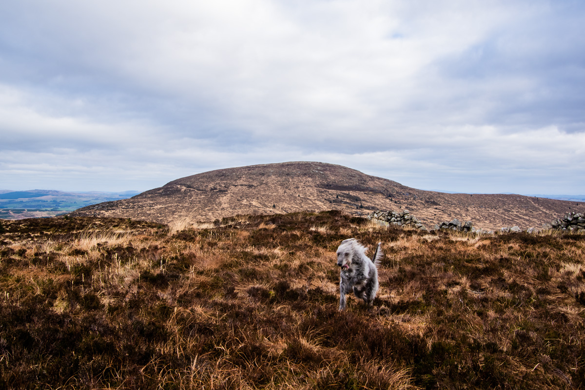
We spent a wee while on the summit with me taking in the views and Messi doing figure-eights at 100mph (he loves the heather) before I decided we really ought to head off to Black Hill of Dee.
So here’s the thing: before I did this walk, while doing my research, I’d read quite a few people moaning about the difficulty of the route between these two hills. ‘Boggy’, ‘soaked’ and ‘broken ankles’ are all terms I’d heard to describe the route. I’m naturally skeptical of such stuff and I like to judge hills and routes for myself.
So we departed the summit of Benniguinea, mobile phone in hand with OS Maps open and I was looking for the track that broke off towards to Black Hill of Dee. To be honest, at first, it’s largely non-existant.
“…prepare to weep if you are not on the faint waterlogged path through purgatorial veg.”
Bjorn at Hill-Bagging
Finally, I decided to just cut through the heather where the OS map said there was a track and it wasn’t long until a faint path appeared. Curling to the left around the rocky crags on the slopes of Benniguinea, the little track drops down into flat moorland between the two hills.
“The terrain is typical of this area, deep tussocks, boggy ground, care needed or twisted ankles at best.“
Desmond at WalkHighlands
Bare in mind we were doing this walk in February after heavy rains. My advice is to ignore all the warnings of how hard this route is: I’ve been on far, far worse. If you find the little track and stay on it the going is quite easy. By the time we reached the base of Black Hill of Dee, my boots were still relatively dry.
The ascent of Black Hill of Dee was easy also. There are no false summits and the going isn’t particularly steep or trying. I found the rocks and heather quite easy to traverse and the faint track is still apparent and easy enough to follow right to the summit cairn.
I was really enjoying the day out and every look back over my shoulder was revealing better and better views. To my right, the clouds were parting and some god-rays were pouring through over the heather.

Coming over the ridge we were immediately made to feel unwelcome as a large raven was croaking at us, circling around, and then croaking again. Even Messi had a few trots at it as if to tell it to shush but the raven was having none of it.
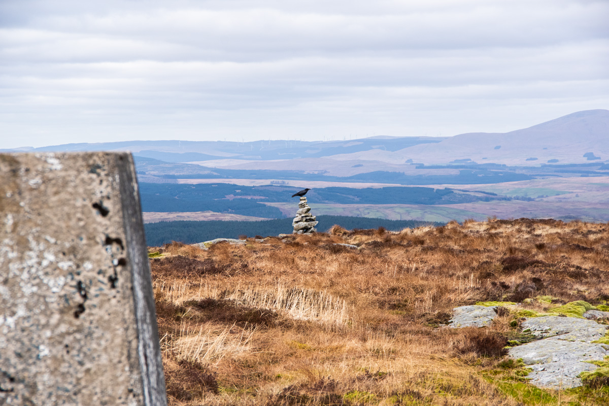
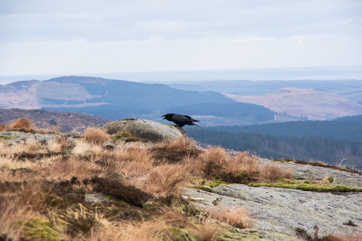
It was clear to me that this fellow felt Black Hill of Dee was his and he was making it perfectly clear we were not welcome.
Just to rub it in, we sat down at the cairn and had lunch while soaking in the views.

Eventually, we set off home, having had a great double-hill day in the Galloway Hills. On the way back down through the forest below Benniguinea, a fox strolled along the track in front of us before slinking off through the woodland. I’d had a great day and I wasn’t exhausted in the slightest.
I’d even enjoyed the grey day we had done the walk on. I try and do walks on good days for the blog (and for getting good pictures) but I love doing walks on grey days too. This isn’t a summer walking blog and anyone who has walked in Scotland’s hills know how nice (and regular) a grey day is. I love the moody contrasts and colours that a grey day provides. This would be a fantastic summer walk on a bright summer day but it would also be a lovely walk on a snowy, cold December day.
Benniguinea and Black Hill of Dee might not be the most famous hills in Dumfries & Galloway, far from it. Most people wouldn’t recognise their names. However if you are in the area and want a nice day in lesser-walked hills, Benniguinea and Black Hill of Dee aren’t to be ignored.
If you’d like to watch me climb Benniguinea, you can watch the video below!
Route Information
Distance: Around 6.5 miles for both hills. Add an extra mile if you want to visit Bruce’s Stone.
Parking: Charged at the Clatteringshaws Loch Visitor Centre but free in nearby laybys.