
Last year I spent two days in the Lake District and as you’d expect I had a great time. The highlight of my trip was climbing the 2,848ft Blencathra, a gorgeous peak north-east of Keswick and my first ever English mountain! I knew then that my two day trip wasn’t enough and that I’d have to return to the area, at least to do some more walking in such a beautiful area.
But which mountain should be next? Of course, I will climb Scaffel Pike some day (the biggest mountain in England and in the heart of the Lake District) and you bet Helvellyn (the 3rd highest mountain in England) is on my list too but this time I decided on Skiddaw. To be honest this was for three reasons:
- It is close to Blencathra and I loved Blencathra. You just can’t get bored of that scenery.
- It seemed likely to be less busy than the famous, larger, counterparts at this time of year.
- The drive from Scotland was a bit shorter. (Hey, at least I’m honest!)
So off I set to the Lake District, to climb my third English mountain. Did I mention I had chosen to do it the hard way?
Skiddaw: Information & Route
Skiddaw sits in the very north of the Lake District, just to the west of Blencathra, close to Keswick. At 3,054ft it is the 6th largest hill in England and not to be underestimated!
Being the utmost professional that I am, prior to heading off I had done my research on the variety of routes one can take to climb Skiddaw. As it turns out, there are quite a few, all of varying degree’s of difficulty, length and ascent. During my research I read the dreaded words that I find so hard to resist: “difficult” and “circuit”.
I would bag this peak via Longside Edge.
This is the best route to the summit of Skiddaw – a worthy way to climb one of England’s highest peaks. – Dave Chick @ MudandRoutes.com
Climbing Skiddaw from Longside edge features a beautiful walk-in from the west, ascending Longside Edge before looping up on to the summit. After which you drop down to Bakestall and pass by Dash Falls (a waterfall in a hidden valley) before walking back to the starting point. All in, it is about 10 miles and is quite steep at points (and very soon after leaving the car!).
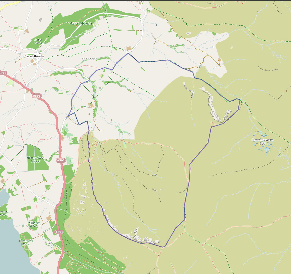
My Circuit Route Of Skiddaw (Created with https://umap.openstreetmap.fr/en/)
Setting Out
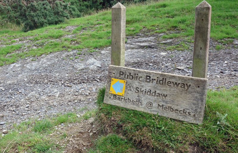
The drive to the Lake District isn’t just beautiful but it’s pretty easy. Coming from the north, I followed the A591 south before turning off and tightly doubling back onto a tight little road. Thankfully, you won’t have to drive far before you see the parking space on the right hand side (big enough for around 6 cars). Next to the parking area you will see a couple of signs for a ‘Public Bridleway to Skiddaw’ which marks the start of the route!
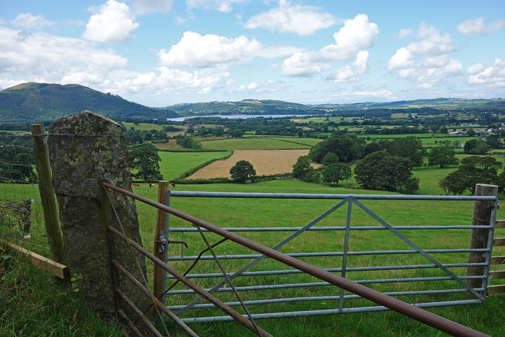
The View From the Parking Area
If you Google this route most websites will stress this difficulty of it. Particularly, the steepness as soon as you set off from the parking area. These things are always so difficult to judge. It depends on individual fitness but I must say: from the car park to the ridge is steep (and it is immediately steep, there is no gentle walk-in) but it’s not that bad either. I think it’d be easy to be put off by some reports on bagging Skiddaw this way but I’d urge you not to be. Ascending through the farmers fields gives you a look at the looming peak of Ulloch Pike on Longside Ridge: it’s impressive looking and a bit daunting!
On the plus side, every time you have to stop to catch your breath you can admire the beautiful views behind you.

Climbing Through the Fields: Ulloch Pike on the Right
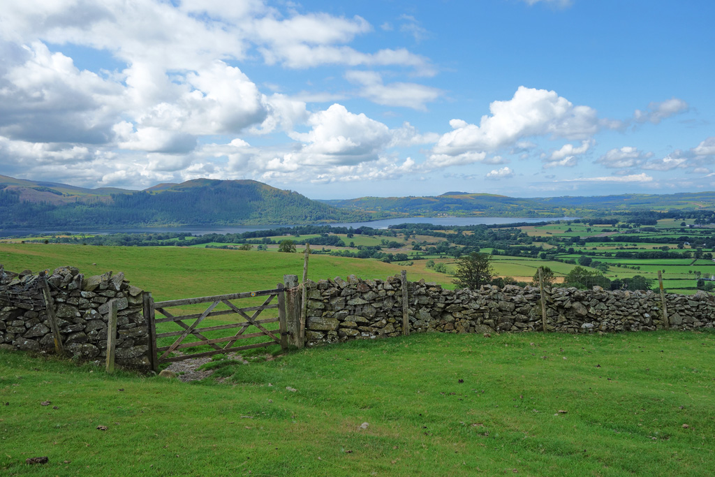
The View Back
Admiring the View (Absolutely NOT using it as an excuse to get my breath back)
Up and Up and Up
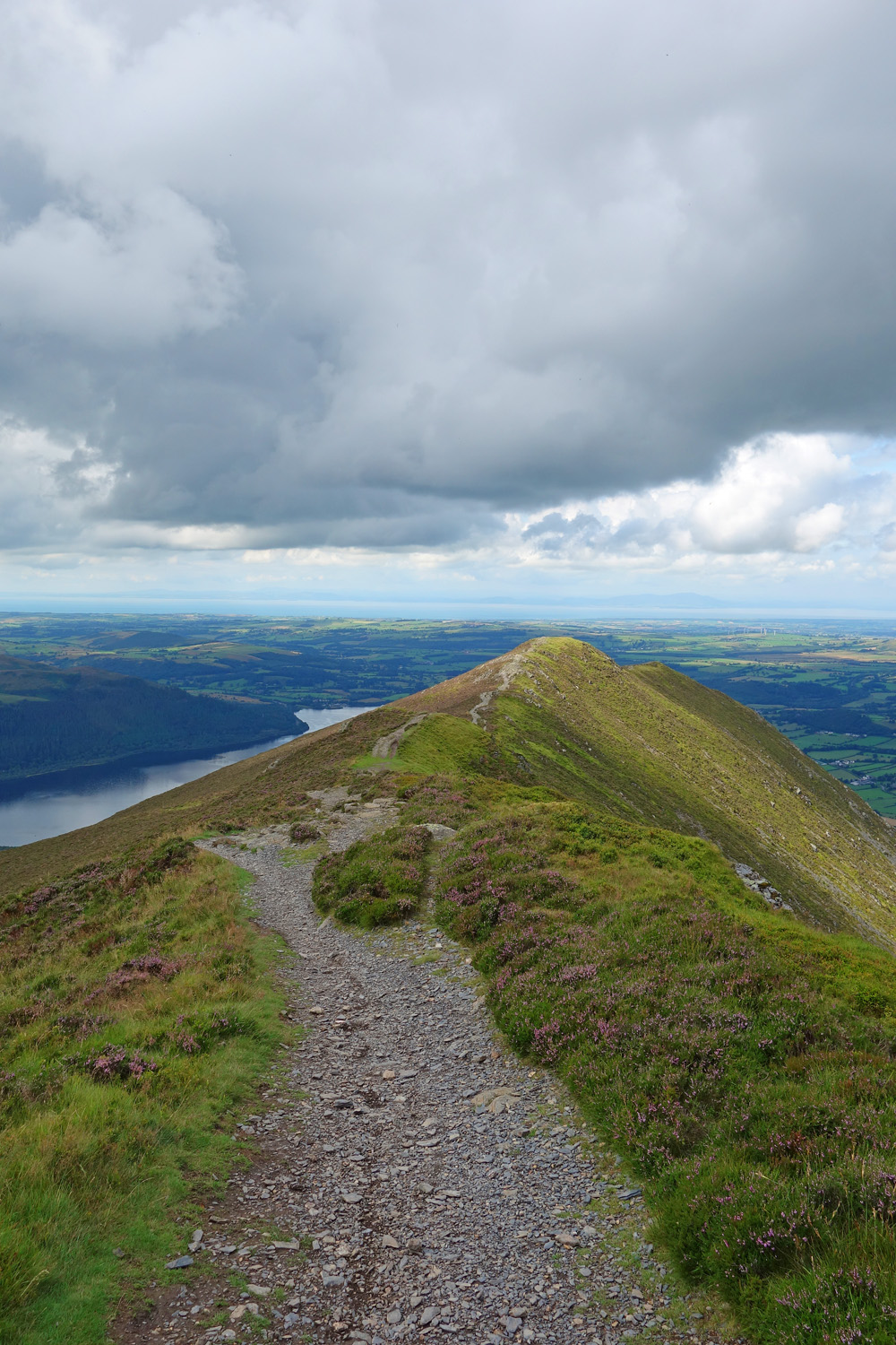
At this point you will arrive in the amphitheatre! The sprawling ridge beckons before you and Skiddaw stands menacingly to the left. It’s a beautiful view and one reason why climbing via Longside edge is so recommended.
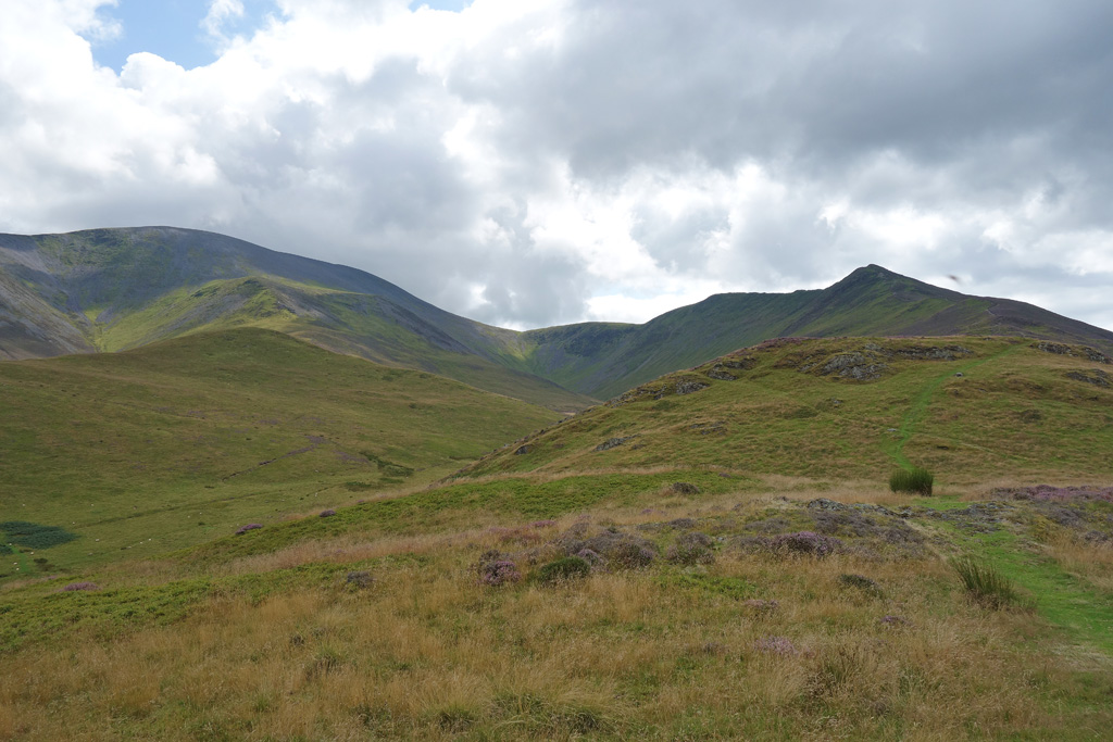
Skiddaw to the Left
The track is easily visible (you can see the green trail to the right in the image above) and you will swiftly gain altitude with every step! Still, I don’t think it is quite as hard as it looks…although I must admit, I was pretty warm at this point and the ascent onto the ridge on the right was very warm work: no doubt not a problem in winter.
Throughout your ascent the beautiful, sprawling, Bassenthwaite Lake will continue to dazzle you with different angles, colours and many photo opportunities. I ended up taking a lot of it throughout my ascent (another wonderful excuse for a break) and I’m still undecided on which images of it were best to use for this post! It has managed to sneak into many of my pictures and it really is a highlight of the day. Just look!
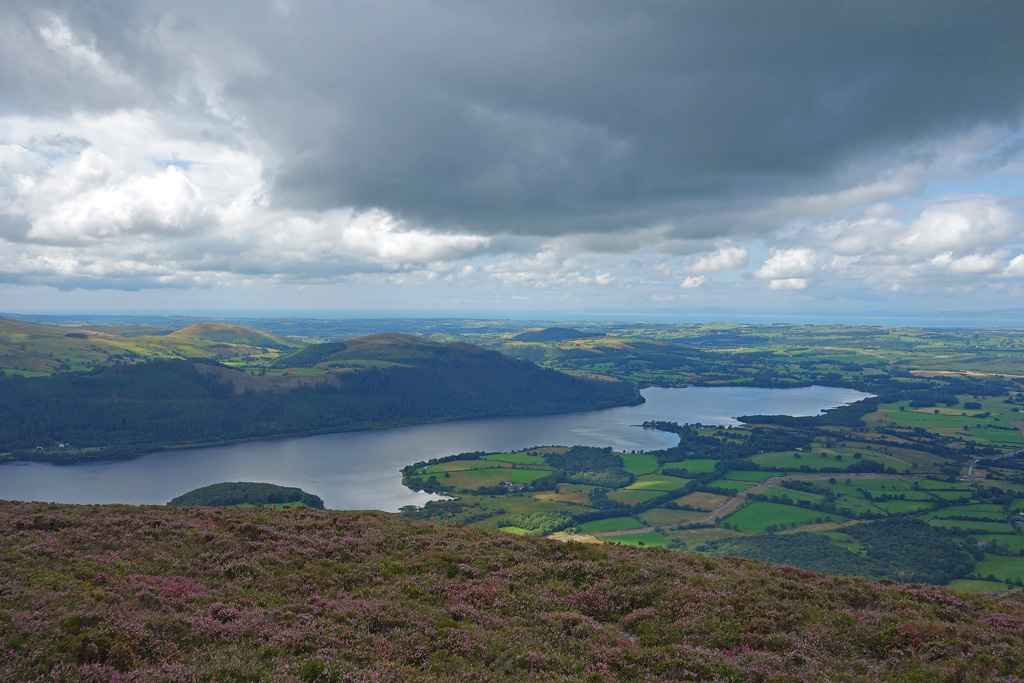
The Beautiful Bassenthwaite Lake
Beautiful
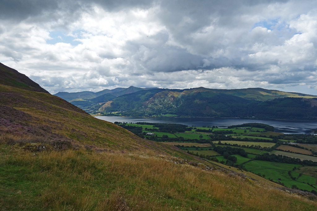
Finally, after much effort, I reached Longside Edge and passed Ulloch Pike & Long Side. The views were staggeringly beautiful, better than I have seen on some summits and this wasn’t even the halfway part of the day. I could see all across the northern Lake District and out across the Solway Firth and into Dumfries & Galloway in Scotland. The photo I took is one of my favourites of the entire year:
What An Amazing Ridge
Bagging Skiddaw
Do you remember back at the start when I said this route wasn’t that hard? And I said it wasn’t that bad?
Well…there is one difficult part.
The part where you actually climb Skiddaw.
(In my defence, if you go back and re-read what I wrote earlier, I said from the car-park to the ridge wasn’t that hard. I didn’t mention from the ridge to Skiddaw’s summit!)
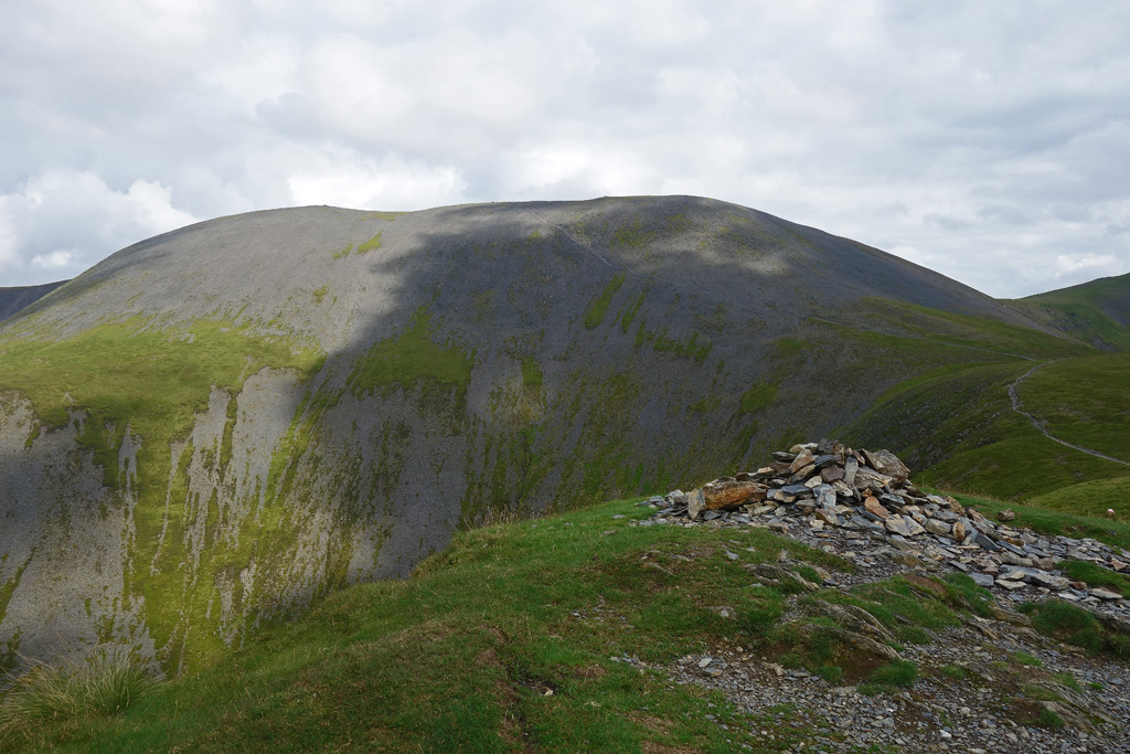
Looking Over to Skiddaw
Once you are up on Longside Edge you can get air into your lungs and enjoy a relatively level ridge walk as you swing gently to the base of Skiddaw.
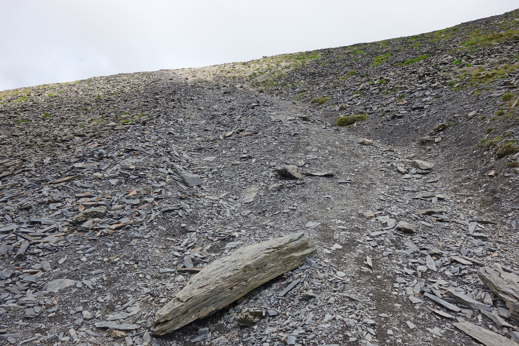
Then you can weep as you get closer to Skiddaw and realise that gentle big lump is actually a very steep, scree scattered mountain that is going to make you earn this last part.
Faced with this impending hardship I sprung into action: I stopped and took many pictures.
“You Can’t Take Pictures Forever”
This Is What Regret Looks Like
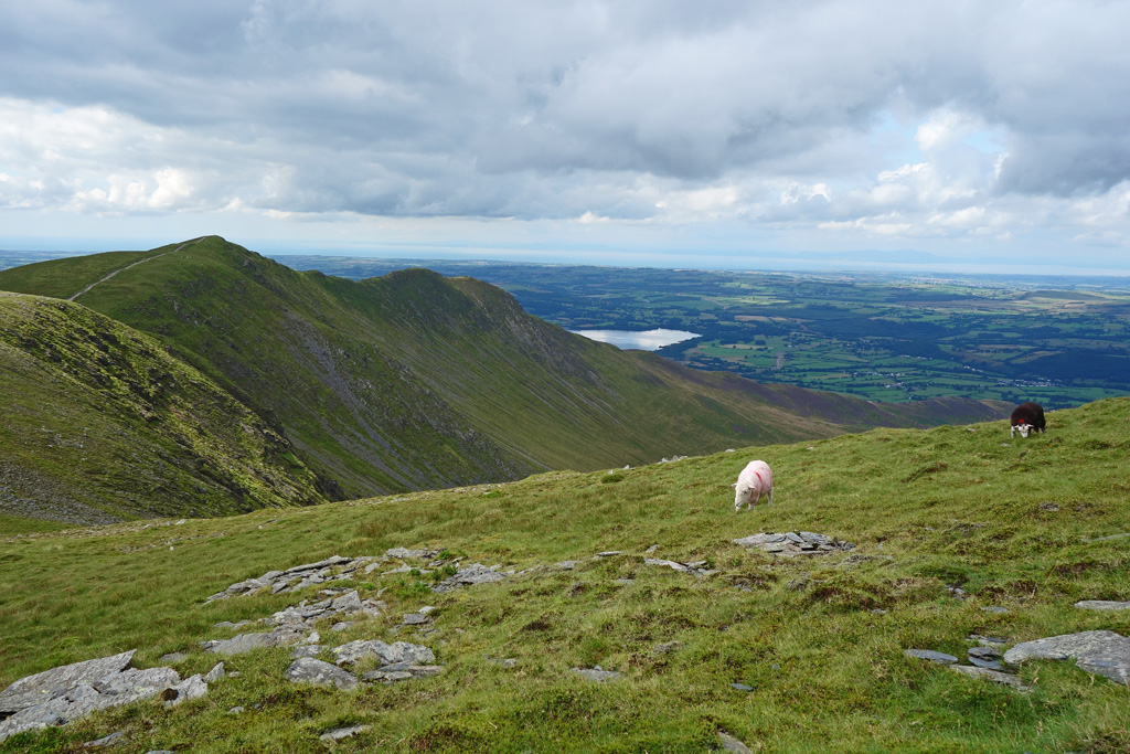
By this point I noticed something. I was the only one going up. A couple passed me with their young son, I stood aside and let them descend. The little fella slipped a few times, saved by his father’s hand. A few lone walkers passed me and I let them by. I slowly ascended, crunching through the skree and marvelling at how steep it was.
I’m sure I could hear those sheep giggling.
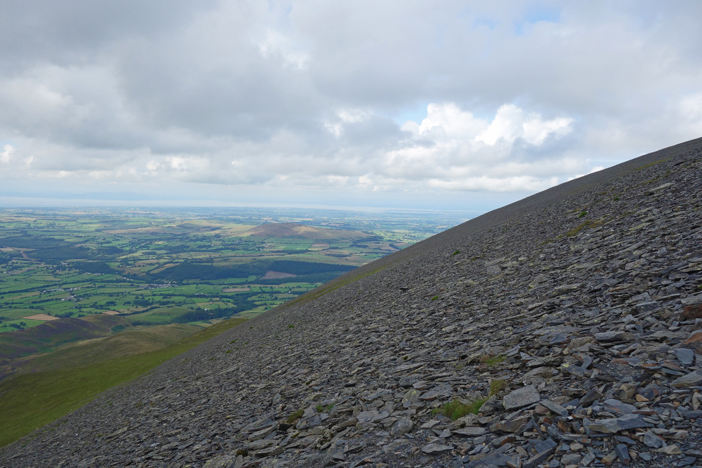
The Gradient
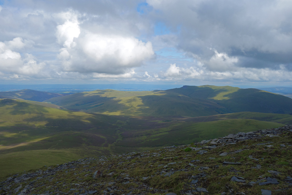
Thankfully, the ascent is hard but short. It doesn’t actually last that long and before you know it you will find yourself coming up over the ridge and onto the summit (there are no real false summits!). I strolled along the top, taking in the breath-taking views in all directions before following the gentle slope up onto the summit of Skiddaw itself.
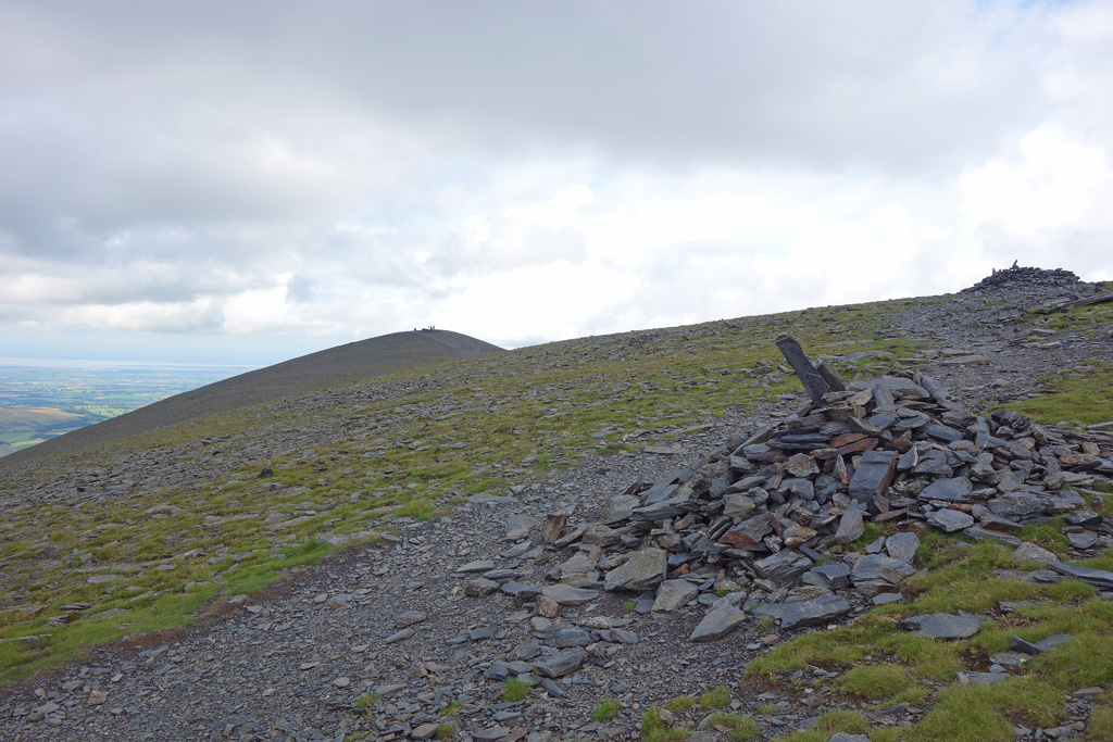
Looking to the Summit in the Background
The Views
The Other Side

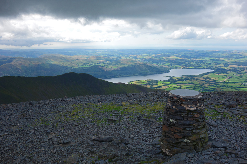
On The Summit
There was just a gentle breeze blowing on the summit and after taking many (many…) photographs, I stopped to have lunch. The summit wasn’t empty but it wasn’t busy either. I watched a few groups come and go, including two lovely women from a local walking club who told me they loved my accent! I took a picture for them and finished my lunch. Skiddaw has a summit I could stay on for hours. The views over the Lake District (north to Scotland, south into the heart of the lakes) is one I could have sat and soaked in for much longer. I think I spent 40 minutes on the summit.
But I still had miles ahead of me, so I packed up and headed off.
And immediately ran into more sheep!
Finishing the Loop
I’m sure sheep like being photographed. I have quite a habit of it, with a particular favourite picture of mine being from my day at Blencathra where a particularly photogenic Herdwick sat for a beautiful picture. Not to be outdone, the sheep on Skiddaw immediately began posing!
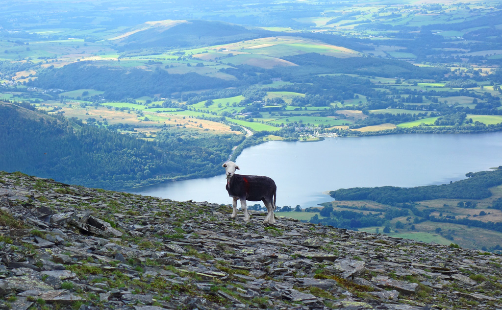
“Hurry up and take your picture”
Not to be outdone, 3 more decided they wanted in on the action.
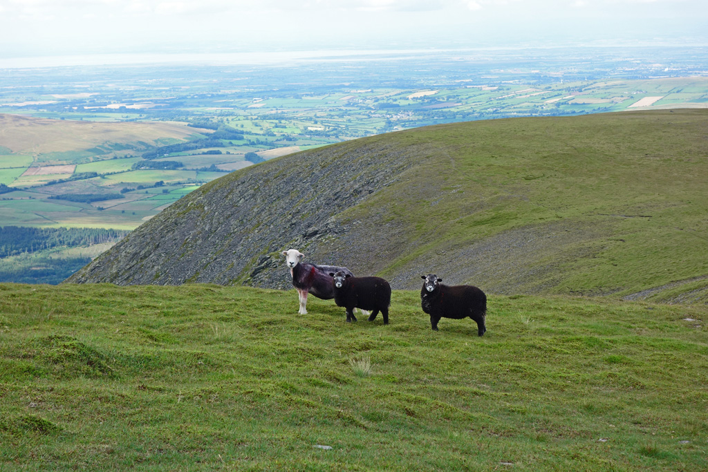
“Make sure you get our best sides”
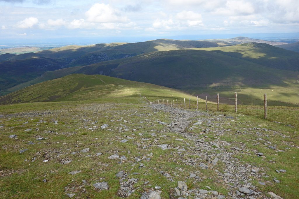
I thanked them for standing so still and moved on and follow the track down to Bakestall, the 2,200ft sub-peak of Skiddaw. The route is clear and pretty obvious, all you have to do is follow the fence as it descends down to the valley below.
Looking Back to Skiddaw (Note the Fence on the Left)
Descending to Bakestall With the Fence as a Guide
You should easily descend into the valley behind Skiddaw, with the lovely sound of the little stream flowing which eventually becomes the very pretty Dash Falls waterfall. I loved the change at this point! Suddenly a mountain hike had transformed into a peaceful stroll along a deserted English valley. It was picturesque, relaxing and very atmospheric.

The Valley With the Water Flowing to the Right – Bliss!
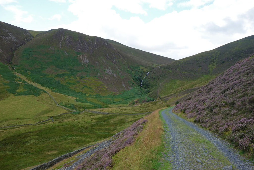
Looking Back to Dash Falls
A Perfect English Countryside Scene
Conclusion
I passed through more sheep fields and couldn’t help but admire the farm buildings that were out in such a gorgeous place. I kept stopping to take pictures and enjoy the atmosphere. As I was descending through the sheep fields I saw a young woman on the path a wee bit ahead of me. She hadn’t noticed me: she was too busy taking pictures of the scenery all around her. I couldn’t help but smile: two completely different people but the same reaction to our surroundings.
We laughed at the fact we were both holding camera’s, she was on holiday and heading to stay at one of the farmhouses I had seen earlier. I bet she had a great time!
What a Frame
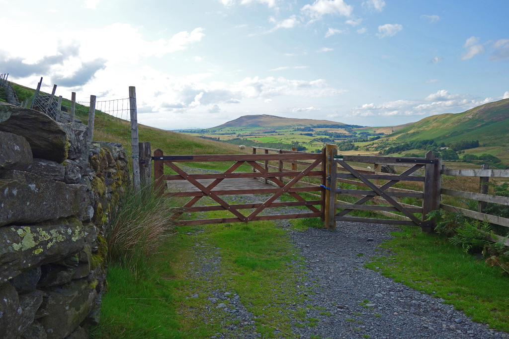
Once out of the fields you return to the little road and it is simply a case of strolling back along it to the parking area at the start. I’d taken well over a hundred photo’s and way too much GoPro footage (coming soon!). Even the return along the road was nice: farmers fields littered with cattle, ducks and hens strolling around farmyards, it was lovely.
By the time I reached the car I had concluded this walk around Skiddaw, via Longside Edge, was one of the best mountain days I’d had.
And that’s no mean feat.
Information
Altitude: 3,054ft
Route Length: 10 miles
Parking: FREE
Video
If you’d like to watch me bag Skiddaw click the video below!
Comments
This is a great blog post. I’ve hiked to the top of Skiddaw this exact way to and have to admit that the first accent from leaving where you park on the side of the road is a tough one. It really gets your legs pumping for the rest of the walk though and the views as you say are something to be admired.
I think the walk to the top of Skiddaw passing over Ullock Pike and Carl Side is spot on, and the final accent to Skiddaw summit is one that simply has to be done while hiking in the Lake District. It’s a joy of a walk and one that I’ve enjoyed reading from you. Your pictures are spot on too and it’s a great little blog post. It’s certainly made me want to book a bread away as soon as possible to walk this route once more.
I thought I’d leave this information page on here, just in case anyone needs any further information about Skiddaw along with your walking route. I hope that’s ok and if it helps one person to get out there like us then it’s a job well done.
https://truefreedomseekers.com/skiddaw-wainwright/
But thank you for the great post and I’ll look forward to reading more from you too.